DendroTech Engenharia e Projetos Florestais
Fone (42) 3304-8330 ou (42) 9977-8330
Geotechnologies
Geotechnologies

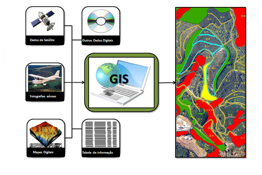
Geotechnologies are tools that enable the creation, manipulation, storage, interpretation and analysis of spatial data in order to assist humans with essential information for sustainable development. The fast and accurate access to information for decision making is a determining factor for the success of any project.

  • Digital thematic maps
  • Digital processing of satellite images and aerial photographs
  • Planning and implementation of Geographic Information System (GIS)
  • Development of rural and forest administrative records
  • Conversion of spatial data platform CAD to GIS

Geotechnologies


Rua Albatroz, 2222 Batel - Guarapuava / Paraná
Fone (42) 3304-8330 ou (42) 9977-8330